September spotlight: 10 best Felt Community maps
Introducing our new monthly community spotlight — we’re excited to celebrate our users who create impressive maps!

Introducing our new monthly community spotlight — we’re excited to celebrate our users who create impressive maps!
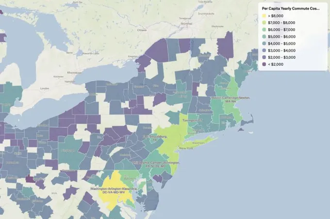
Economic Cost of Commuting
Software engineer and map lover Gabe used the Felt Style Language to create a map that shows the economic cost due to commuting in metro areas in the US (pre-pandemic).
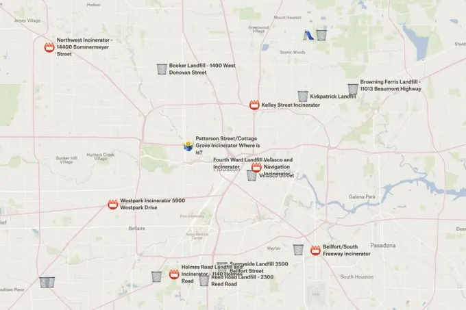
Houston Landfills Map
Texan designer Evan created an Environmental Justice map of Houston landfills and incinerators that were in place from the 1920s to the 1970s. "Dr Robert Bullard, an environmental justice pioneer wrote a book about the effects of these facilities, but there were no digital map representing them; I put this together and will be releasing it to people to get more information on these facilities," says Evan.
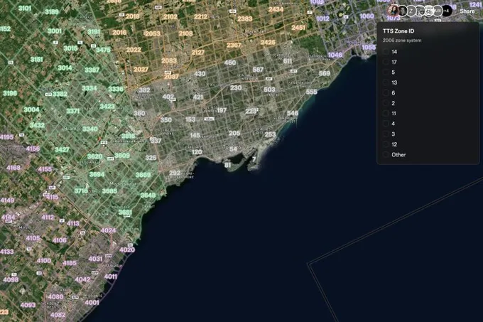
TTS Zones
Toronto-based transportation planner Adam created a map the zone system for a regional travel survey. Before using Felt, he had to refer to a clunky PDF version he had printed out, but with the new data upload feature in Felt he was able to put it together and share with his colleagues.
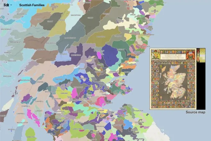
Scottish Families
GIS analyst Chris put together a map that show general spheres of influence of Scottish families (usually about the time of King James VI but taking the history of each district or family as a whole).
Walking with Patrick Leigh Fermor
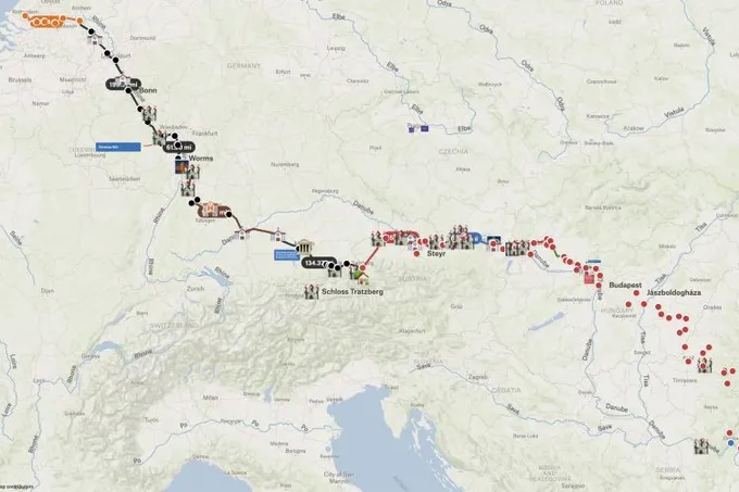
Our community member David used Felt to do some 'active reading' of one of his favorite books, A Time of Gifts by Patrick Leigh Fermor. The book is a recounting of Fermor’s walk across Europe at the age of 18, starting right at the end of 1933.
Morel Spotting
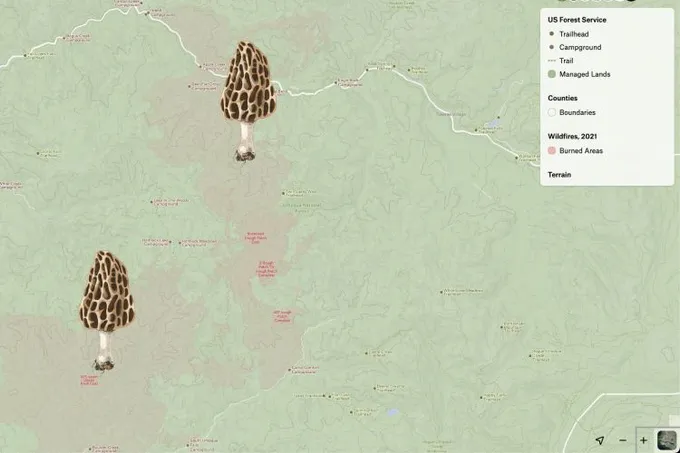
Creative director Croix put together a map to help folks in the Pacific Northwest find morels. "By overlaying past wildfire burns with national forest data I can find public lands that will likely produce morels in the spring! Nearby campground data can be used to plan a weekend forage with a campsite as a home base," suggests Croix.
Minecraft Run
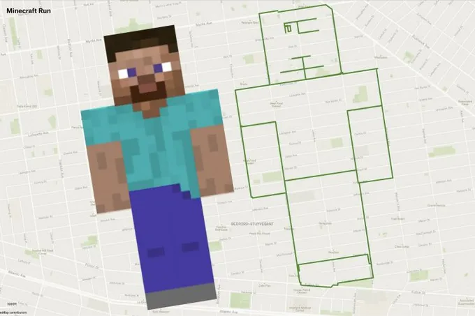
NYC resident Alex traced a Mincecraft character on the city streets!
Baguio Trip
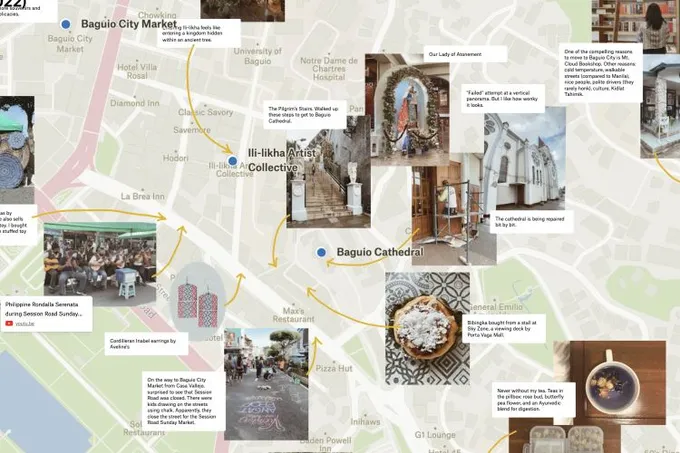
Data analyst Phoemela used Felt to journal during her trip to Baguio (Philippines).
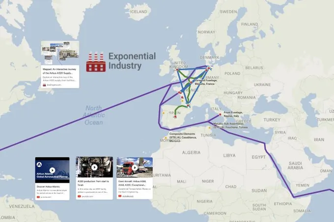
Airbus A320 Family Supply Chain
Manufacturing and supply chain expert David used Felt to visualize the Airbus A320 supply chain with this interactive journey.
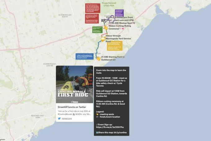
Conlins Murals First Ride Route
Earlier this summer, Nithursan led a group ride to celebrate a community mural unveiling along a local bike lane in Toronto. The group needed access to a special detour and Nithursan used Felt to communicate a simple map of the route plan with the local city councillor which helped in getting their approval.
Want to share your map and get featured?
We recently launched our new community where you can connect with other folks using Felt. Post your favorite Felt maps there and we will feature the best maps at the end of October!