December spotlight: 10 best Felt Community maps
Felts have been busy putting maps to use – from outlining Santa’s route around the world to analyzing NYC accidents.

Here is how Felts were putting maps to use during this holiday season — from outlining Santa’s route around the world to analyzing NYC bike accidents data.
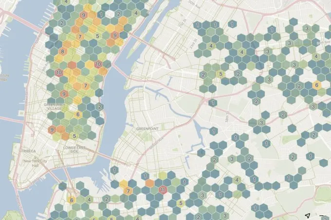
Bike Accident Trends in NYC
Software Engineer Quy used the New York City Police Department data to create this beautiful hexbin visualization. He also wrote a post about the process behind creating this map.
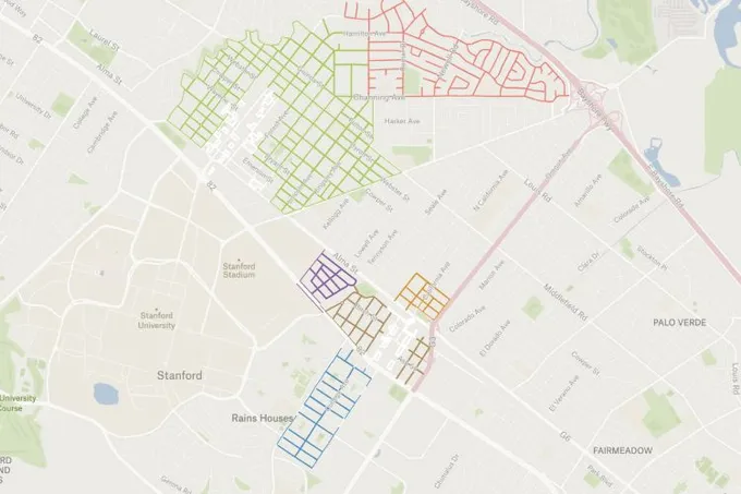
Residential Preferential Parking Districts
The City of Palo Alto mapped residential preferential parking (RPP) programs.
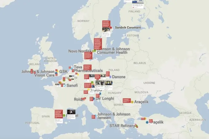
Global Lighthouse Network
The World Economic Forum and McKinsey named the most advanced factories in the world. David Rogers created a map that brings you inside them for his Substack, Exponential Industry.
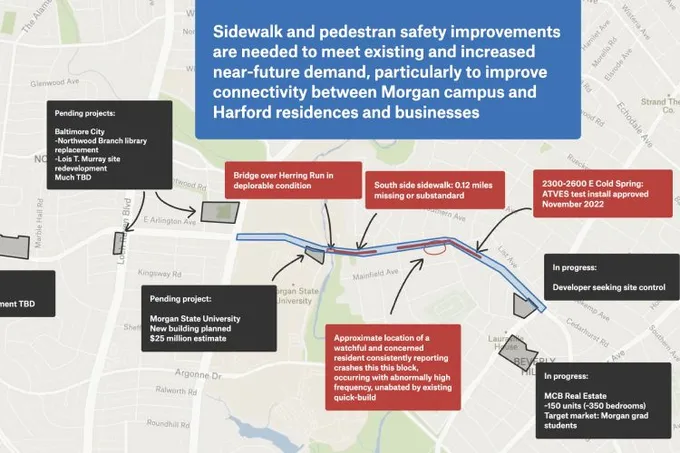
Baltimore Sidewalk Improvements
Ryan used Felt to depict which sidewalk improvements are necessary to meet existing and future demand between Baltimore’s Morgan State campus and Harford’s residences and businesses.
Camping Sites in the UK
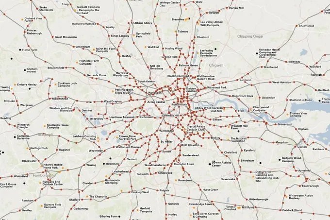
Think you need a car to go camping? Not if you’re in the UK. Will made a map of every campsite within walking distance of transit.
Not Safe for Bikes
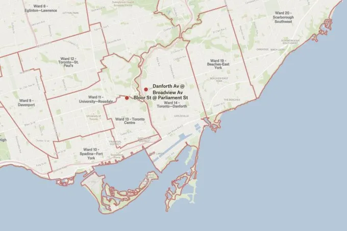
The Bicycle Mayor of Toronto shared a map of routes that are not safe for bikers.
Most Gray Whales Are Capricorns
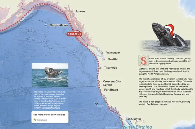
It’s Capricorn season, so RJ whipped up a map ode to his favorite Capricorns of all — gray whales! Learn about the gray whales’ cycle of migration in his beautiful map.
Santa’s Route
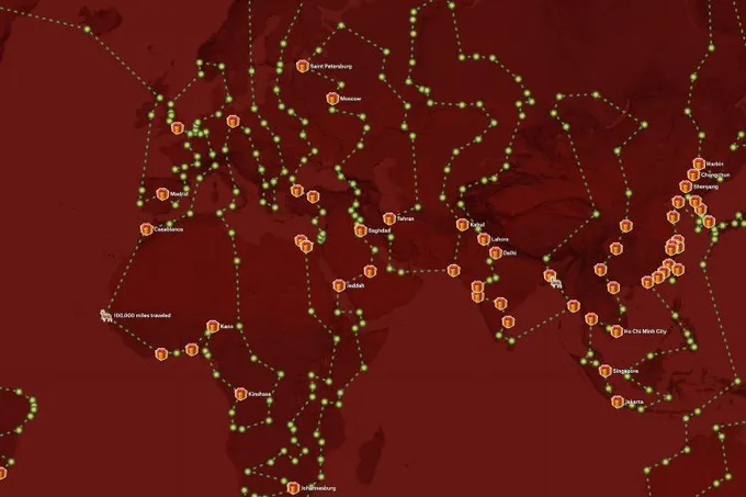
Samuel revisited a 2014 Santa’s route proposed by Ben Blatt for Slate. Samuel created a map showing all the points, highlighting the top 100 cities in the world, and tried to design a custom basemap with a Christmas vibe.
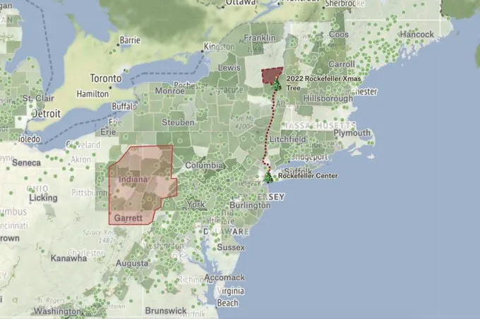
Christmas Trees around the World
This map helps you explore tree harvesting data from USDA, find your local farms, go on a little scavenger hunt for some iconic Christmas Trees around the world!
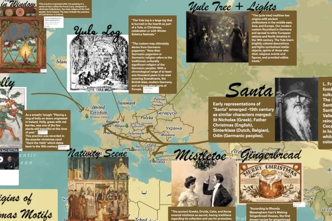
Christmas Motifs Then and Now
Angelica wanted to know what is popular today in the States to use as Christmas décor and where these motifs came from. She was most excited to portray the data in a "vintage Christmas" style using a customized basemap (Mapbox), customized state decor badges and fonts, and use the new color picker to match the aesthetic of the map.
Want to share your map and get featured?
We recently launched our new community where you can connect with other folks using Felt. Post your favorite Felt maps there and we will feature the best maps at the end of January!