CartographerFeltCategoryReal estate
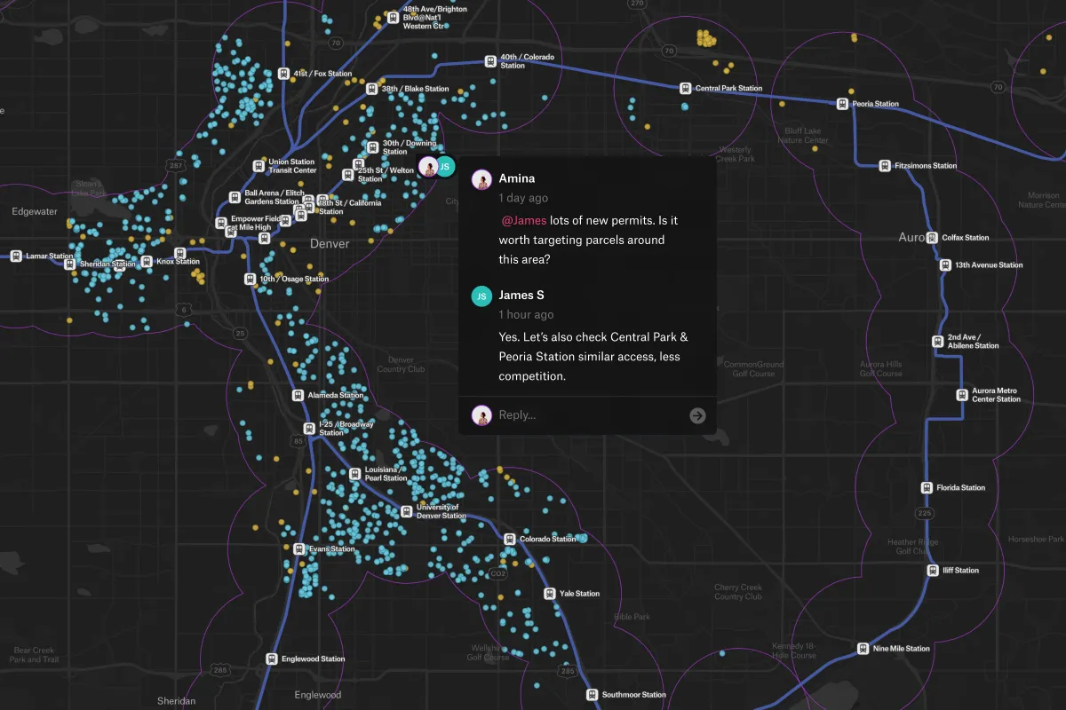
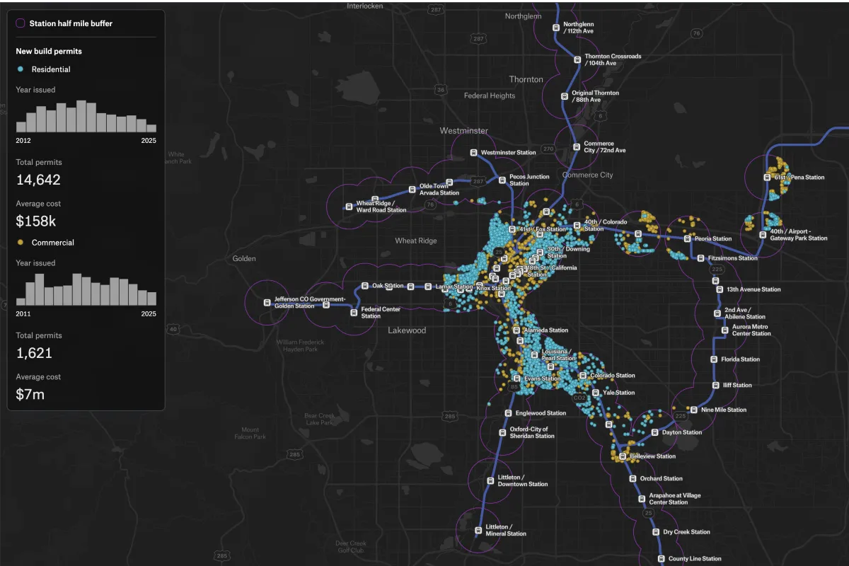
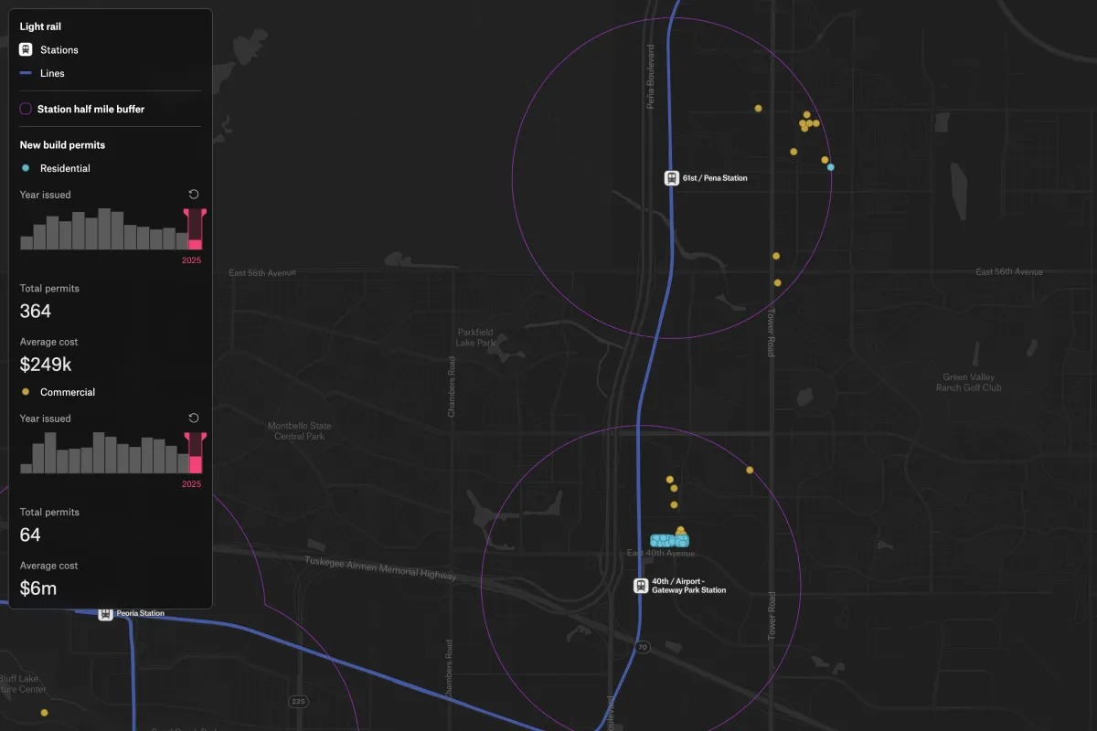
This map shows residential and commercial permits in Denver with light rail lines and station areas, helping real estate teams monitor transit‑oriented growth and spot new opportunities.
Track new development near transit to anticipate growth opportunities.
This map shows residential and commercial permits in Denver with light rail lines and station areas, helping real estate teams monitor transit‑oriented growth and spot new opportunities.
Connect a database or drop in a file and see your data live on a map in minutes.