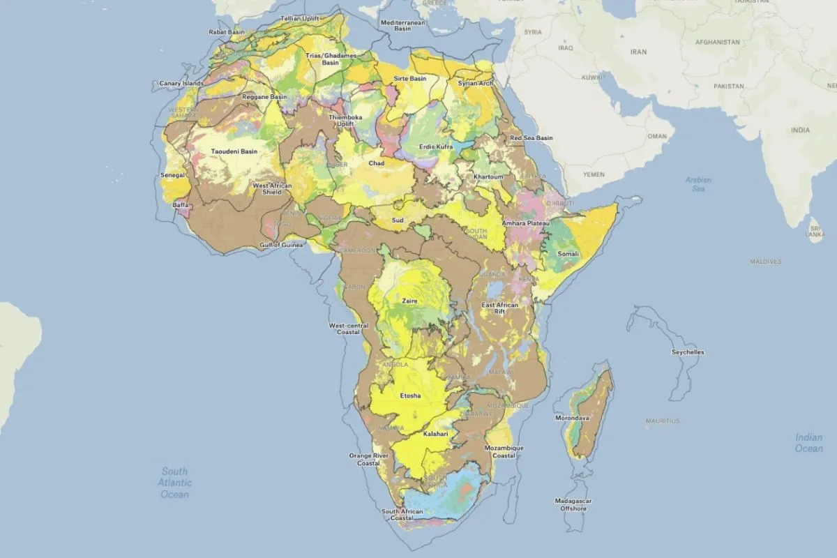
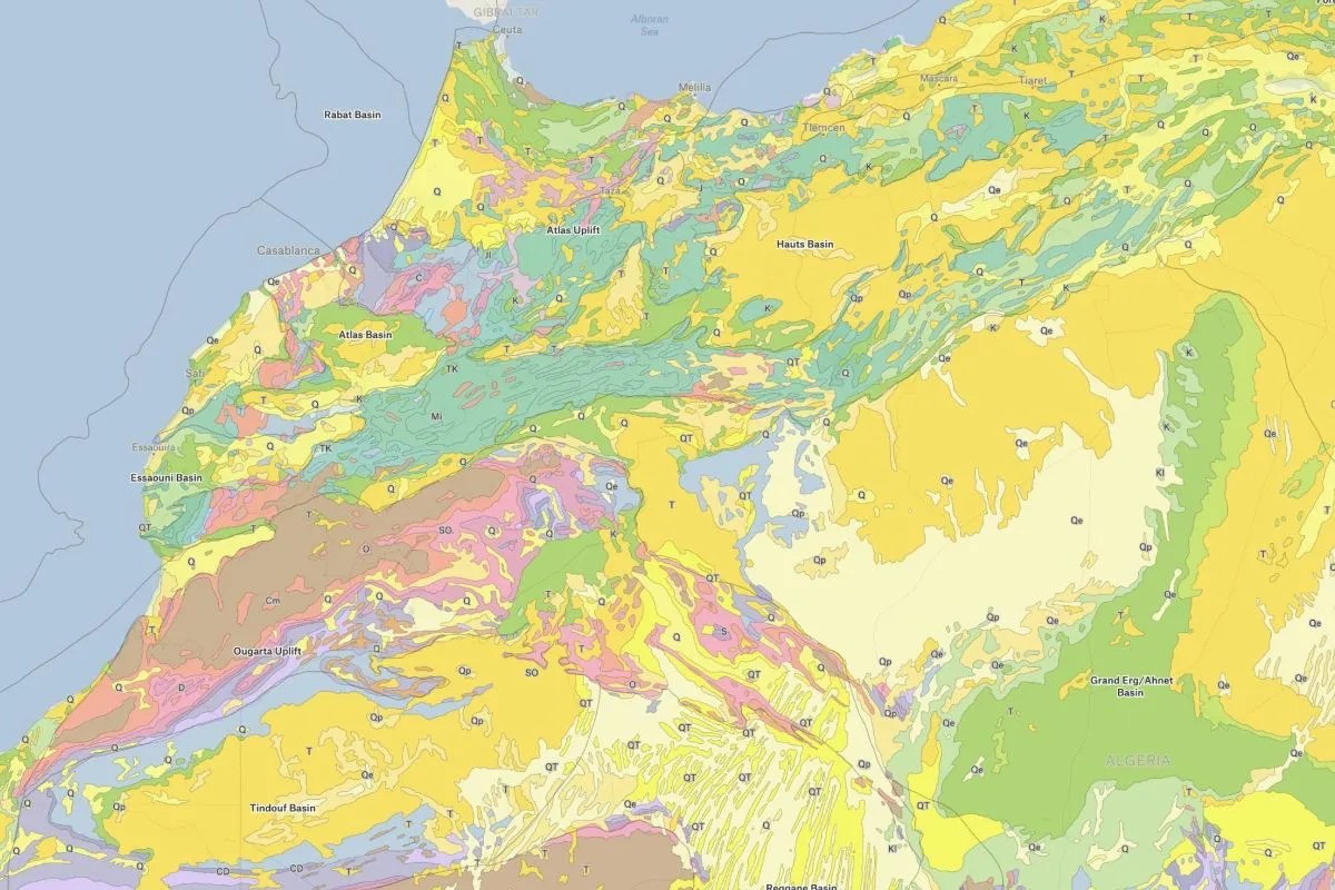
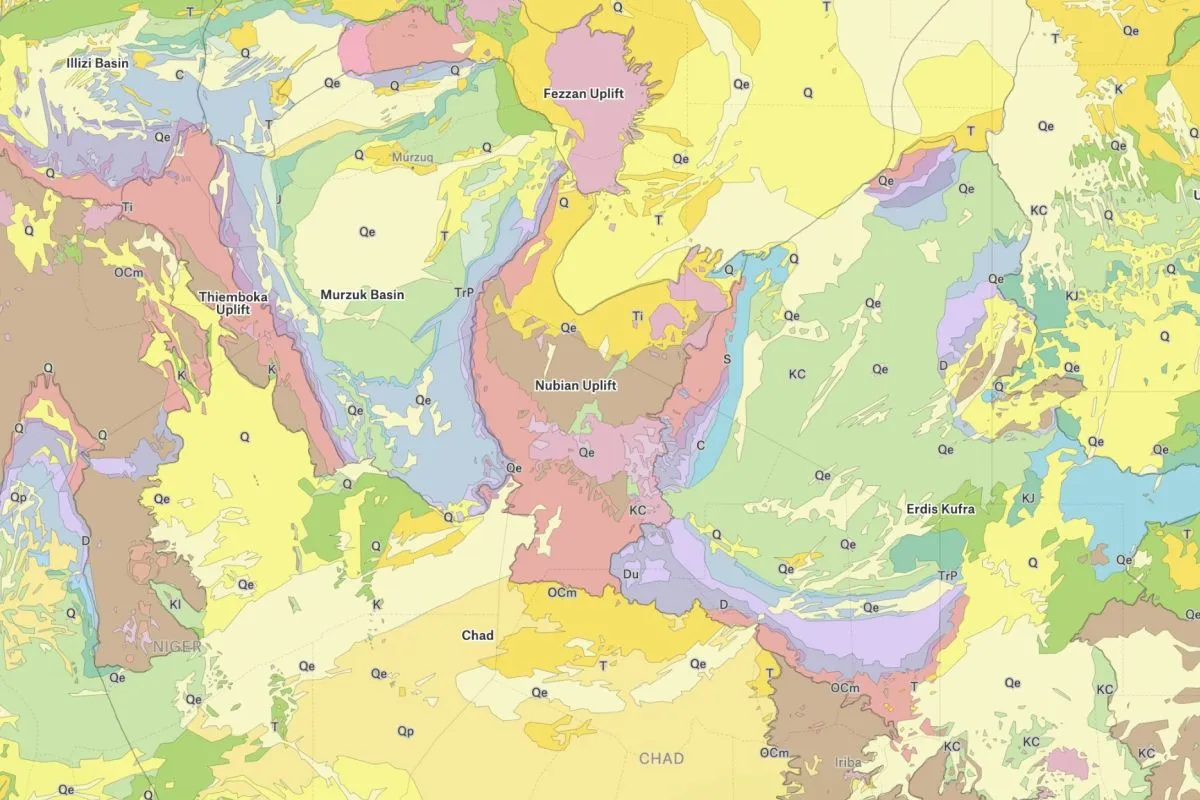
The African continent is a vast and diverse landmass, shaped by a variety of geological formations. From the towering peaks of the Atlas Mountains in the north to the vast expanse of the Kalahari Desert in the south, Africa is home to a rich array of landscapes and ecosystems. This map, which draws on data from the U.S. Geological Survey, provides a glimpse into this remarkable geological diversity, highlighting the continent’s many mountains, valleys, plateaus, and other landforms.
Geology of Africa
More views
FAQ
Common questions
01What kind of rocks are in Africa?
Africa contains a diverse range of rocks including ancient Precambrian crystalline basement rocks (granite, gneiss), sedimentary rocks (sandstone, limestone, shale), volcanic rocks (basalt, tuff), and metamorphic rocks (quartzite, schist). The continent is particularly rich in ancient cratonic rocks, as well as significant deposits of valuable minerals including diamonds, gold, platinum, and copper-bearing rocks.
02How old is Africa geologically?
Africa contains some of Earth’s oldest rocks, with cratonic shields dating back 3.6 billion years or more, making them among the oldest continental crust on the planet. Much of the continent sits on ancient Precambrian basement rocks between 540 million and 3.8 billion years old. Africa is considered geologically ancient because it has been relatively stable with less tectonic activity than other continents.
03What are the main geographical features of Africa?
Major geographical features include the Sahara Desert (world’s largest hot desert), the Great Rift Valley, the Congo Basin rainforest, the Nile River (world’s longest), the Atlas Mountains, Mount Kilimanjaro, the Ethiopian Highlands, Lake Victoria, extensive savannas and grasslands, the Kalahari Desert, and distinctive plateaus that characterize much of the continent’s topography.
Try Felt
Bring your data, see it on the map
Connect a database or drop in a file and see your data live on a map in minutes.