10 maps that push the boundaries: fire progression, Colorado River basin & more
Curious to see what all of our new features can do? Check out these ten maps.
With our game-changing data launch, the possibilities of what Felt is capable of exploded. Here are just a few examples of what is now possible on the platform.
Each of the embedded maps below have styles you can copy and use on your own maps using the Advanced Style Editor & Felt Style Language, or duplicate and start using as-is! Jump in and explore!
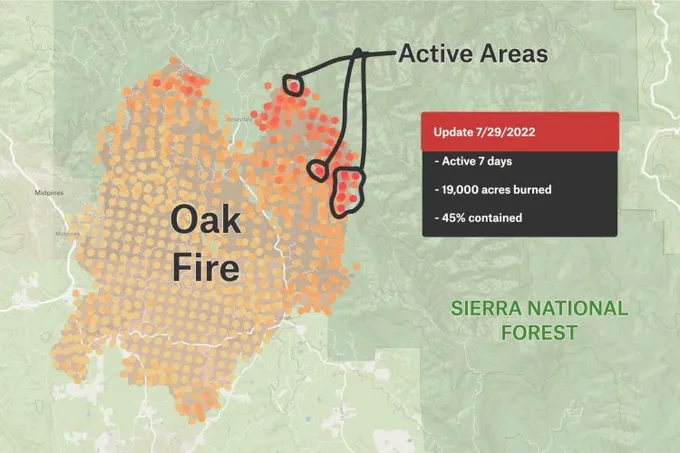
Fire Progression: The Oak Fire
The Oak Fire progressed over 19,000 acres, just 30 miles west of Yosemite.
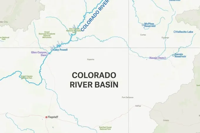
Colorado River Basin
Approximately 250,000 square miles, the Colorado River Basin is expansive–and running out of water.
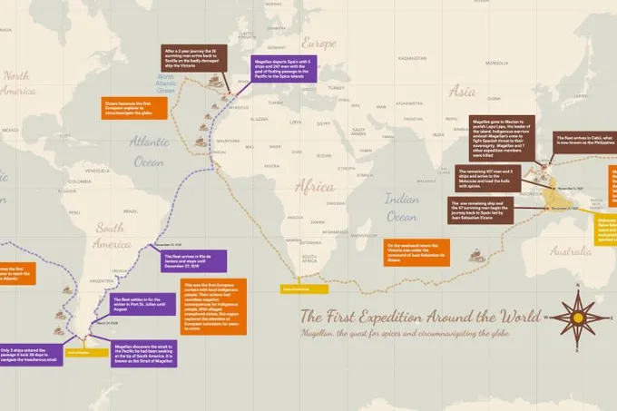
The First Expedition Around the World
Maps are a great way to tell stories. Follow Magellan *almost* all the way around the world and peek under the hood to see how we got this historical map look.
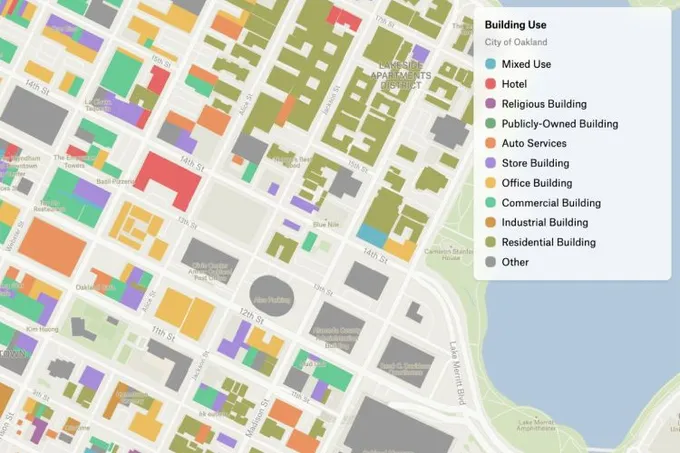
Oakland Building Use Codes
Toggle uses on and off in the legend to get a sense of buildings’ permitted uses in Oakland, California.
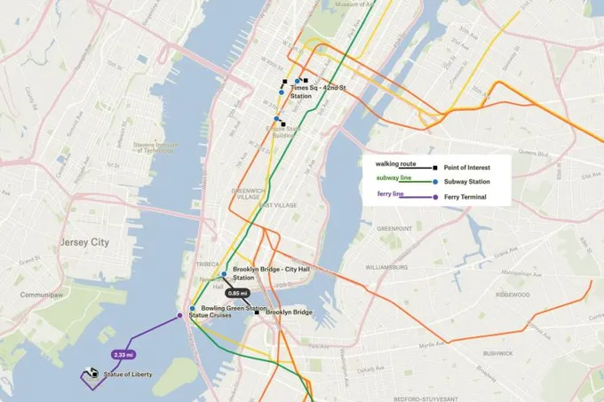
Visitor’s Guide to New York
Whether making a map for a conference or for your wedding guests, helping them navigate the transit system with line colors is critical.
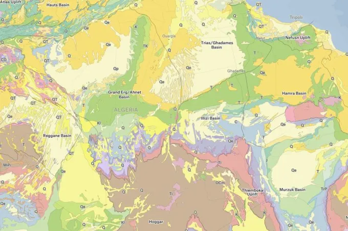
Geology Map of Africa
The new categorical map style opens up all sorts of new visualizations, like this map of the geological make-up of the African continent.
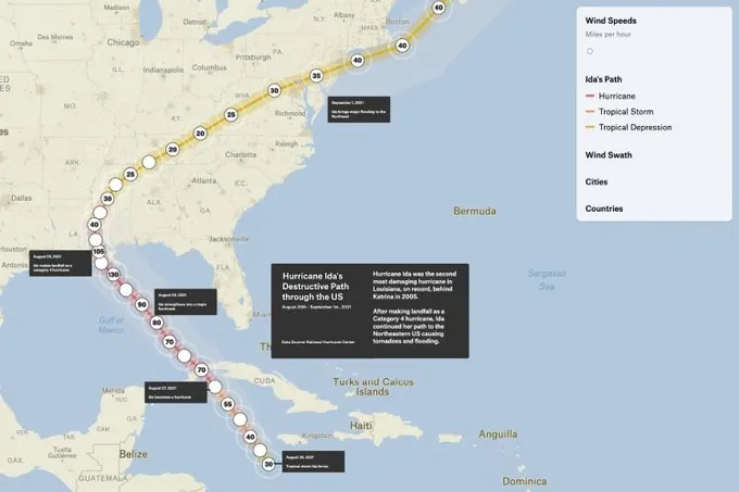
Hurricane Ida’s Path
When Hurricane Ida hit southeastern Louisiana, it was a category 4 hurricane. Check how it picked up speed in the map below.
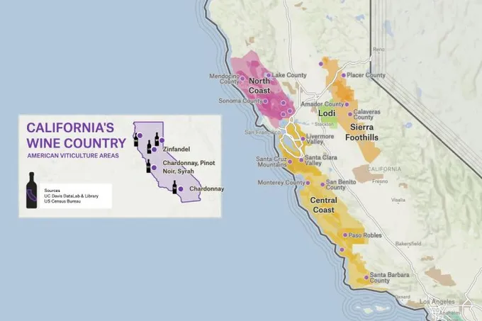
Wine Regions of California
Track where all your favorite wines are from when you duplicate this map of California wine regions.
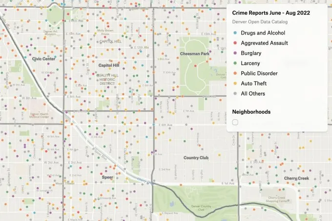
Denver Crime
We mapped Denver’s crime data in under five minutes with our Style Editor.
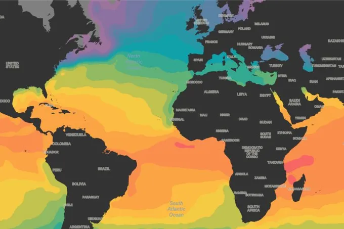
Sea Surface Temperatures Across the Globe
Check out what sea surface temperatures were like the week of September 4, 2022.